Profile
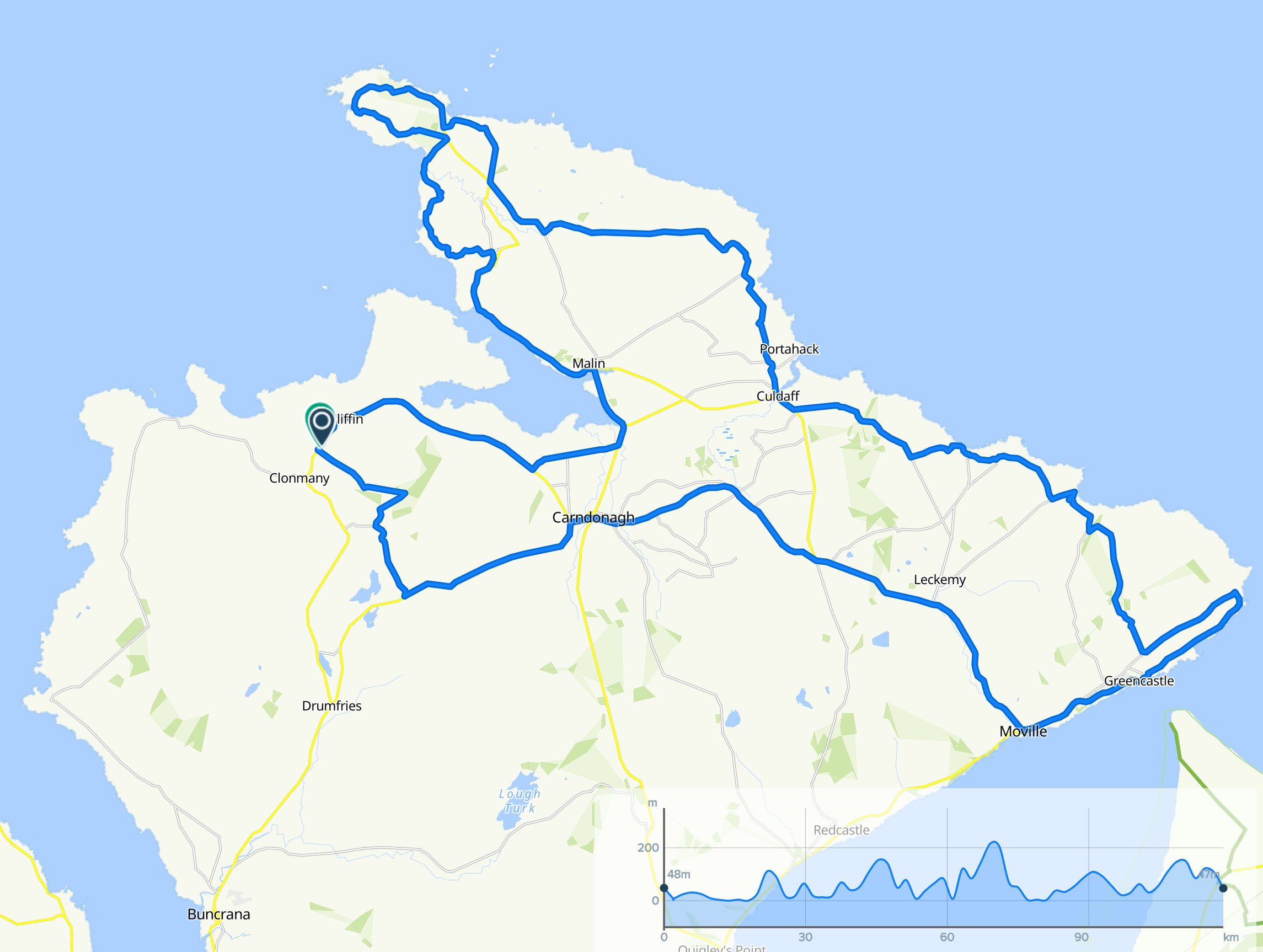
The North Inishowen Coastal Route
The North Inishowen Coastal Route is a 120km route that traverses the northern part of Inishowen. You can start and finish the route anywhere If you start from Clomany and head north it will take you past the famous Ballyliffen Golf Course past the Isle of Doagh along the coastline of Trawbreaga Bay and onto the lovely village of Malin Head.
You then carry on North past five finger strand beach with some of the highest sand dunes in Europe and onto Irelands most northerly point at Banba’s Crown. From here you start to travel south through some of Inishowen’s most remote areas to Culdaff with its blue flag beach. The route then keeps going south until it reaches the lighthouse at Shroove at Inishowen Head.
It continues south along Lough Foyle until Moville before cutting west up to Carndonagh where you will pass and view the St Patricks cross and then return to Clomany.
Local Accommodation Options for Your Perfect Getaway!:
Are you looking for local holiday accommodation options in and around Clonmany?
Important disclosure: Inish View is a proud participant in the Booking.com Affiliate Program. This means if you choose to make a booking through the provided link below be assured that you won't incur any extra charges.
However, by using this link, you are supporting us as we may receive a small commission. Your support means the world to us! Thank you for choosing Inish View and happy travels!
Local Hotels near here:-
Details
Map
Sorry, no records were found. Please adjust your search criteria and try again.
Sorry, unable to load the Maps API.
Accomodation, Food and Drink Close By
Ballyliffin
inishowen
Ireland
Ballyliffin
inishowen
Ireland
Ballyliffin ED
inishowen
Ireland


