Introduction
Everyone who lives, or has ever visited the Inishowen Peninsula knows what a wonderful and beautiful place it is. It has astonishing scenery, a long and rich history and a fantastic cultural scene. So whatever you are looking for the Inishowen Penisula is definitely the place to go.
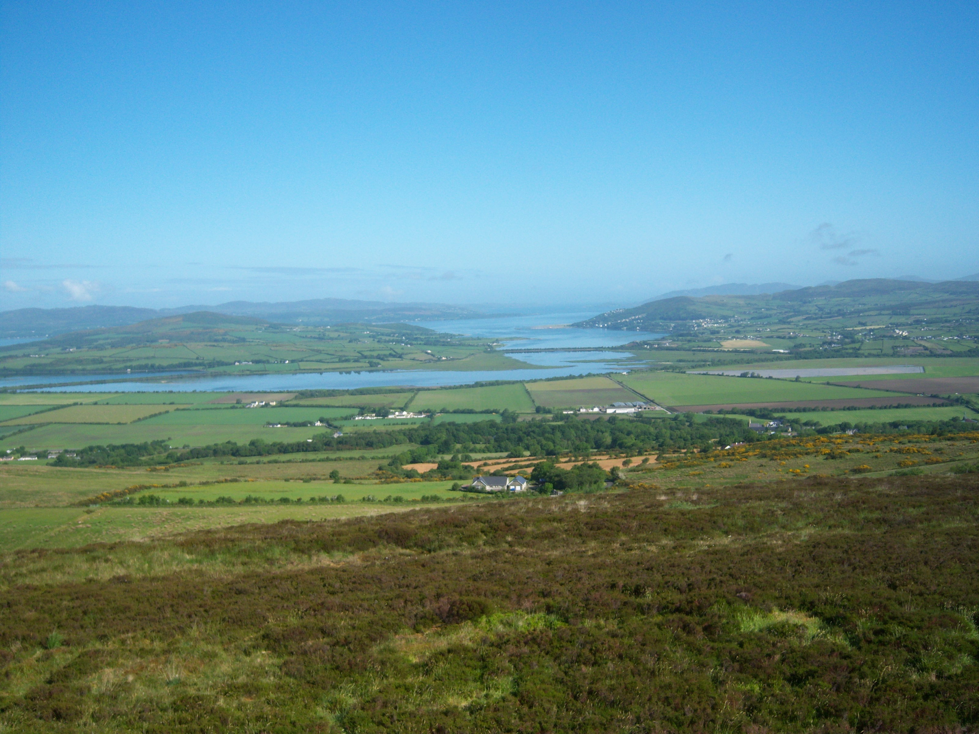
Wherever you go in Inishowen, you will come across some of the most spectacular scenery you can find anywhere in the whole of Ireland. From the rocky cliffs of Inishowen Head and Banba’s Crown to the heather-clad mountains in the Penisula’s interior.
You have the stunning golden sandy beaches which are scattered all around the coastline, two of which have been awarded the prestigious blue flag. The Inch Wildlife Reserve in the south of the Penisula is one of the most significant places in Ireland for migratory birds coming down from the artic to spend the winter feeding here.

The people here are very welcoming, and there is a vibrant local music scene as well as plenty of cultural events to go and see. There are festivals throughout the year, with several of them renowned throughout Ireland. One thing is for sure, you will find a warm welcome wherever you go.
The Inishowen Penisula is full of activities for you to do. There are loads of water-based activities, like kayaking and surfing. Three of Irelands top 100 golf courses are here, and there are a further four within an hours drive. There are lots of walks to go on, from easy-going coastal walks to mountain top hikes.
If it is something more relaxing you would like, there are a few local hotels that have spa treatments. There is also the opportunity to take part in outdoor yoga sessions at some idyllic and scenic spots. To see a full list of activities available Inishowen click here, and for events in the area click here.
The geography of Inishowen
The Inishowen Peninsula is the most northerly point in the whole of the island of Ireland. It is also the largest peninsula with a total landmass of 884.33 square kilometres.
With the Atlantic Ocean to the north, Lough Swilly to the west and Lough Foyle to the east the Penisula is surrounded by water.
The highest mountain in Inishowen is Slieve Snaght, which is 619 metres above sea level. Bogland and rocky outcrops cover the small mountains that make up most of the interior of the Penisula. Other mountainous areas can be found in the Urris Hills to the east and around Malin Head to the north.

Malin Head Urris Hills Looking over to Fanad from the Inishowen Peninsula Eire 80


The History of the Inishowen Peninsula
People have been living in Inishowen since at least the bronze age. Inishowen has several sites dating back to this time, about 4 000-5000 years ago.
We have great examples of Rock Art, some of the best examples of this type in the whole of Ireland. They can be found mainly on the Isle of Doagh. Other great sites from around this period are the Morton God Dolmen portal tomb and the Bocan stone circle.
There must have been lots of activity going on in Inishowen in the early middle ages as there is evidence of several monasteries built in the area. There is not much left of the buildings, but several high crosses from the period are still standing. There is the Saint Mura’s Cross in Fahan, and the Carrowmore High Crosses near Culdaff for example.
In the early middle ages the O’Doherty clan, who were Lords of the Inishowen peninsula at the time built several fortifications in Inishowen. A few of them that remain today like O’Doherty’s Keep in Buncrana and Carrickabraghy Castle on the Isla of Doagh.

Rock Art Bocan stone circle carrickabraghy castle Cooley’s cross


The West Inishowen History & Heritage Society is a fantastic group which knows the local area extremely well. You can follow them on facebook by clicking here or go to there website here.
Author: neil
administrator and owner of inishview.com