Profile
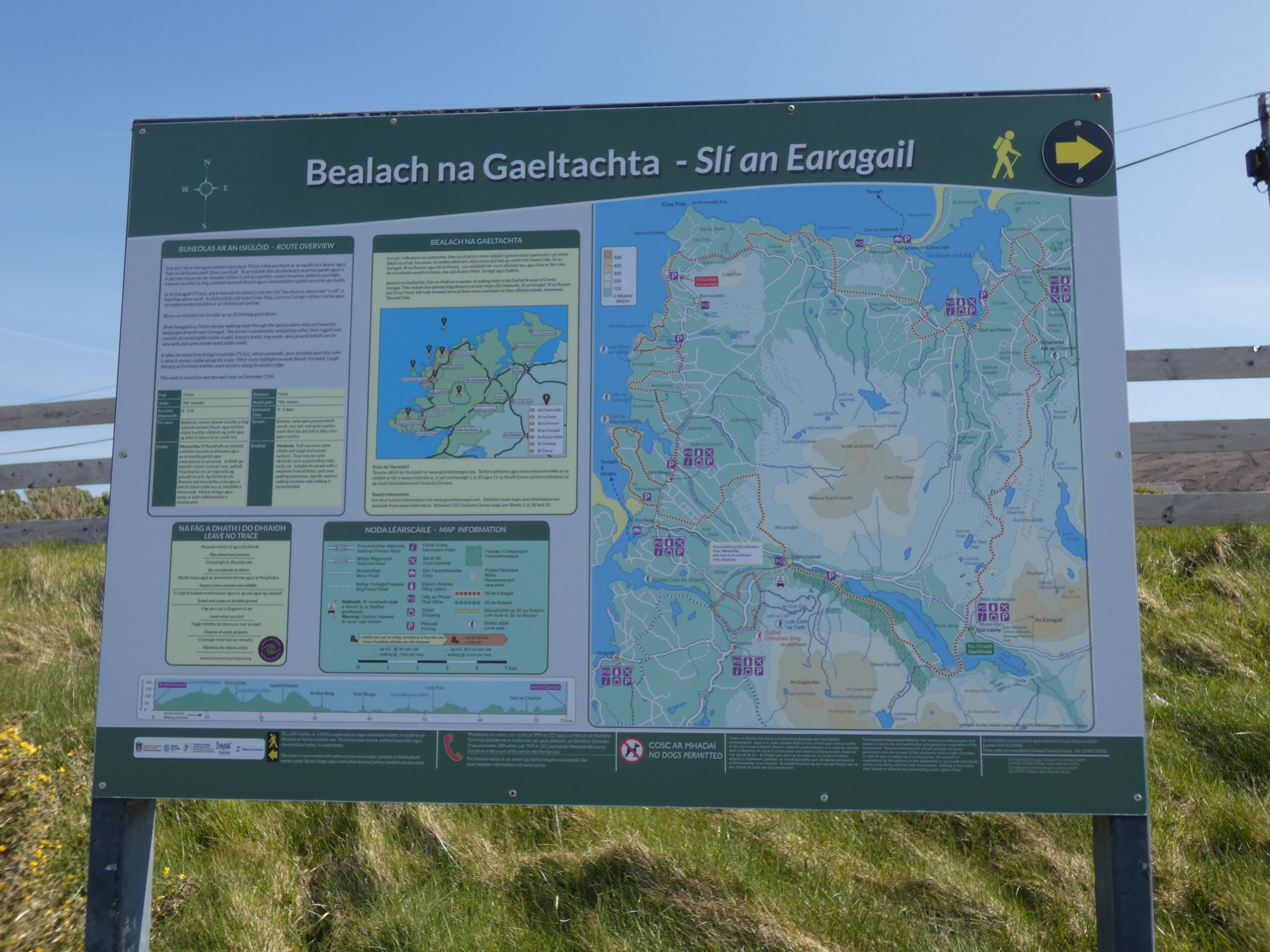
Slí An Earagail
Slí An Earagail is a 77 km long distance looped trail with spectacular views and has several places where you can start and finish the trail including the towns of Falcarragh, Derrybeg, Bunbeg and Gweedore as well as Dunlewey.
The route passes past Donegal’s highest mountain and crosses moorlands to the Atlantic Ocean. The route is mainly on minor roads but also crosses coastal paths, forestry tracks and bog roads.
For more details about the walk click here.
You will find plenty of activities and sights in and around the walk (Click on the links below for more details):-
- Dunlewey Kayaking
- Walk the Poisoned Glen
- Errigal View Pet Zoo
- Glenveigh Castle National Park
- Teach Mhuiris Heritage Cottage
- Donegal Copper Craft
- Bloody Foreland Sea Arch
- Slí An Earagail
- Cnoc Fola Wild Atlantic Way Discovery Point
- The Old Church Dunlewey
Local Accommodation Options for Your Perfect Getaway!:
Are you looking for local holiday accommodation options near the Slí An Earagail?
Important disclosure: Inish View is a proud participant in the Booking.com Affiliate Program. This means if you choose to make a booking through the provided link below be assured that you won't incur any extra charges.
However, by using this link, you are supporting us as we may receive a small commission. Your support means the world to us! Thank you for choosing Inish View and happy travels!
Local Hotels near here:-
Details
Map
Sorry, no records were found. Please adjust your search criteria and try again.
Sorry, unable to load the Maps API.
Accomodation, Food and Drink Close By
Gortahork
North Donegal
Ireland
Dunlewy
West Donegal
Ireland
Annagry
West Donegal
Ireland
Dunfanaghy
North Donegal
Ireland
Other Activities Near Here
Dunlewey
North Donegal
Ireland
Meenalough
North Donegal
Ireland
Dunlewy
West Donegal
Ireland
Bunbeg
North Donegal
Ireland
Dunlewy
West Donegal
Ireland
Towns and Villages Near Here
Dunlewey
North Donegal
Gortahork
North Donegal


